Browse categories
Explore
Fiverr Pro
English
$
USD

Geospatial Analyst
Skills
See my services
project scientist
UPRSAC • Full-time
Jul 2022 - Nov 2024 • 2 yrs 4 mos
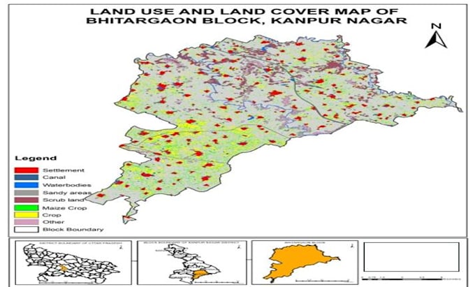
Worked in Agriculture Resource Division at UPRSAC. Responsibilities included satellite data, interpretation, image processing, crop acreage estimation, land use/land cover mapping, masking, maps Unsupervised Classification, and report preparation using GIS & Remote Sensing tools.
GIS Consultant
LRM Consultancies • Full-time
Jan 2021 - Aug 2021 • 7 mos
Worked on Land Use / Land Cover (LULC) mapping and updation for urban planning purposes Performed satellite image interpretation and classification for accurate land use assessment Conducted georeferencing of raster datasets for spatial alignment and analysis Updated spatial layers in support of the Master Plan 2031 Edited and maintained vector datasets including road networks and land parcels Managed attribute data and ensured accuracy of GIS database Prepared thematic maps and layout outputs for planning documentation
GIS Engineer
Reskaled Technologies • Full-time
Jun 2020 - Dec 2020 • 6 mos
Worked on Land Use / Land Cover (LULC) mapping and updation for urban planning purposes Performed satellite image interpretation and classification for accurate land use assessment Conducted georeferencing of raster datasets for spatial alignment and analysis
