Browse categories
Explore
Fiverr Pro
English
$
USD

Skills
See my services
Digitalizador de mapas
Freelance • Freelance
Feb 2023 - Present • 3 yrs 3 mos
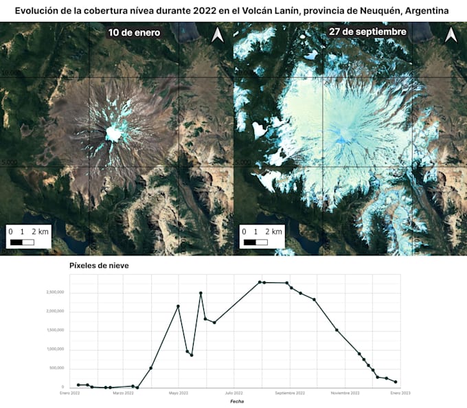
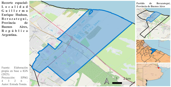
I am a GIS and remote sensing specialist with experience in freelance geospatial projects and academic research. I work with satellite imagery, spatial analysis, and geospatial data processing using tools such as Google Earth Engine and GIS software. My background includes developing environmental and territorial analysis projects, creating maps, and producing data visualizations to support research and decision-making. I focus on delivering clear, accurate, and useful geospatial insights for each project.
