Browse categories
Explore
Fiverr Pro
English
$
USD


Hello!
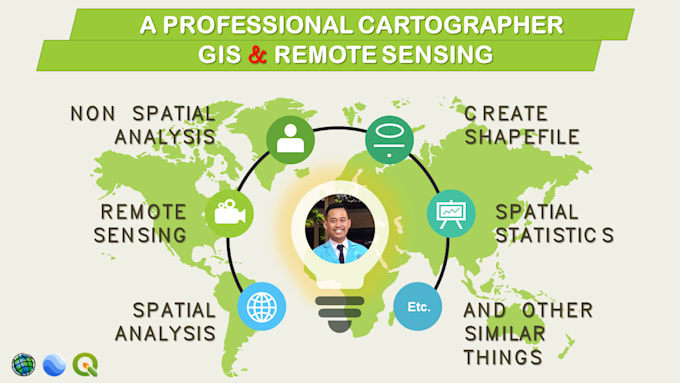
If you're looking for GIS Mapping and Remote Sensing services, you've come to the right place. I have experience and expertise in GIS and Remote Sensing. From land mapping to monitoring environmental changes, I'm ready to assist you in utilizing GIS technology and Remote Sensing to generate valuable geographic information and support better decision making.
SERVICES:
- Network Analysis and Routing
- Create Maps from Google Earth Pro
- Shapefile, Feature Class, Geodatabase, KML and KMZ
- Georeferencing
- Digitization of Point, Lines and Polygon in Vector format
- Spatial Analysis and Non Spatial Analysis
- Hydrology and Watershed Mapping
- Lineament/Lineament Density Maps and Rose Diagram
- Drainage Pattern
- Topographic Maps (Contour and Shaded Relief)
- Topology/Cross Section
- Spatial Statistics
- Land Use Land Cover
- Land Suitability for Agricultural Crops
- Etc.
SOFTWARE:
- ArcGIS
- QGIS
- Google Earth Pro
Please contact me before placing orders.
Regards,
Boris Okta
Keep moving
Languages