Browse categories
Explore
Fiverr Pro
English
$
USD

Level 2


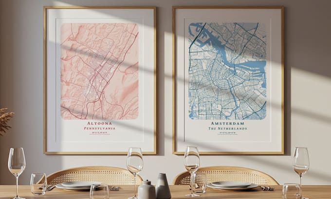
Get a striking, one-of-a-kind street map to display in your home, office, or store. It can be a map of your hometown or place of business, a memento of a city you visited, or just a beautiful piece of art to decorate a room. There are 16 standard color schemes to choose from (see gallery) or we can custom tailor the map to your specific needs. For the U.S. and some other locations, you can get dramatic relief shading to highlight hills, mountains, and valleys added to the map for no extra cost.
Please contact me before ordering so I can give you a price quote and ensure I have the data required to make the map you need. I deliver print-quality PDFs that you can print yourself or take to your local printer; I do not ship printed maps.
Available sizes include A3, A2, A1, 30x40cm, 40x50 cm, 50x70cm, 12x16", 12x18", 15x20", 16x20", 16x24", 18x24", and 20x30". Prices start at $35 for 30x40 cm or 12x16".
When you place an order, I will message you as soon as possible to confirm the map extent, color scheme, and overall appearance. You will be sent a low-resolution version of the map for approval before the final version is produced. Some orders can be filled within 24 hours.
Please inform the freelancer of any preferences or concerns regarding the use of AI tools in the completion and/or delivery of your order.
Geography and maps are my passion
Level 2
Languages