Browse categories
Explore
Fiverr Pro
English
$
USD

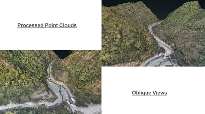
Are you looking for professional UAV Photogrammetric processing (from Images to LiDAR data) for your GIS, surveying, or mapping project? I can help transform your raw UAV data into accurate geospatial products ready for analysis and mapping.
I specialize in drone photogrammetry processing and LiDAR point cloud classification to produce high-quality terrain and mapping outputs for engineers, surveyors, planners, and GIS professionals.
Services I Offer:
Deliverables Include:
GeoTIFF Orthomosaics, LAS/LAZ classified point clouds, 3D Texture models for visualization and measurement, DEM/DSM elevation models, contour shapefiles, and GIS-ready formats.
I use professional tools like PIX4DMapper, DJI Terra, DJI Modify, Global Mapper, ArcGIS Pro and QGIS to ensure accurate results.
GIS Analyst, Spatial Analysis, Mapping, Remote Sensing, LiDAR, Photogrammetry
Languages