Browse categories
Explore
Fiverr Pro
English
$
USD




Why Hire an Expert for LULC?
Accurate Land Use Land Cover (LULC) data is the foundation of any resilient urban or environmental strategy. I specialize in high-precision spatial analysis by leveraging Machine Learning (Random Forest) and the massive computational power of GEE to provide more than just a map, I provide a validated, policy-ready evidence base.
What I offer:
I am a UGC NET qualified researcher and City Professional with Master's in Cities and Governance from TISS. My background in Public Administration and hands-on experience with organisations such as Janaagraha and the Odisha State Finance Commission enable me to bridge the gap between complex GIS data & policy Insights.
Spatial Analysis Expert
Languages
How is your work different from a standard GIS freelancer?
I am a UGC NET-qualified researcher and City Professional. Beyond technical mapping, I understand the Policy Analysis side. My experience technical analysis and policy organisations ensures that your LULC data is presented as a "validated evidence base" for urban governance.
What data do you use for LULC classification?
I primarily use multi-spectral satellite imagery from Landsat (5, 8, and 9) and Sentinel-2 via Google Earth Engine (GEE).
How do you ensure the accuracy of the classification?
I perform a rigorous Scientific Validation. I use a Random Forest ML algorithm and conduct an Accuracy Assessment (generating a Confusion Matrix, Kappa Coefficient, and Overall Accuracy) to ensure the data is reliable for policy or academic use.
Can you analyze land-use changes over a long period?
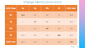
Yes. I specialize in Change Detection and longitudinal assessments. I can analyze transitions over decades (e.g., comparing 2014 to 2024) to quantify urban sprawl, vegetation loss, or water body shrinkage.
What geographic area size can you handle?
Thanks to GEE’s cloud computing, I can handle very large study areas. I have previously completed a comprehensive assessment for Pune City covering 527 sq km. I can work on large areas, such as the state of Maharashtra or Uttar Pradesh (India), as well.
What file formats will I receive?
You will receive high-resolution GeoTIFFs (raster), Shapefiles (vector), and a Statistical Summary (CSV/Excel) of the land-use changes. I can also provide a professional map layout in QGIS.


