Browse categories
Explore
Fiverr Pro
English
$
USD

Level 2

Remote sensing and GIS is my research field. I have more than of 6 years experience in the field of RS and GIS. The satellite data I have used include: SRTM DEM, ASTER DEM, Landsat 7, Landsat 8, Sentinel 1 and Sentinel 2 multi-spectral imagery . I can provide services in the following areas:
Civil Engineering Design, Building Drawings, Stormwater Management
Level 2
Languages
Can you develop GIS Location Mapp?
Yes. I can create any type of location map on demand.
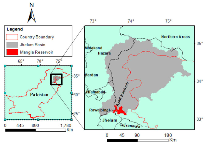
Can you delineate river catchment area?
Yes. I can delineate river catchment area using remote sensing based DEM (digital elevation model).