Browse categories
Explore
Fiverr Pro
English
$
USD
Web Development, GIS, Web GIS, Cartograpy,Remote Sensing
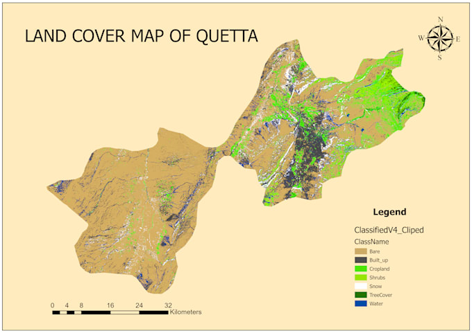
Are you looking for accurate, high quality Land Use Land Cover (LULC) mapping and spatial analysis for your research, environmental study, or urban planning project? You are in the right place.
I am a Geospatial Specialist with hands on experience in processing satellite imagery, training machine learning classifiers, and generating publication ready spatial data. I transform raw satellite data into meaningful, actionable maps.
**Services**
1-Image Preprocessing
2-LULC Classification
3-ML Classifiers
4-Temproal Analysis
5-Accuracy assesment
**Tools**
ArcMap,QGIS,Python,GEE
**Deliverables**
1-Source Files
2-Output Map
3-Statistical Report

Technology:
Excel
•
Jupyter Notebook
•
arcgis
•
Pandas
•
MySQL
Expertise:
Trends
•
Prediction
•
Time series analysis
Programming language:
Python
