I will provide gis mapping and spatial analysis services

A
ahmad_writes_at
A
ahmad_writes_at
Ahmad Saleem

About this gig

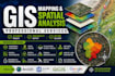
Are you looking for a professional GIS expert for mapping, spatial analysis, or geospatial projects?

With over 5 years of professional experience in GIS, Remote Sensing, and Engineering Geology, I provide accurate, reliable, and customized GIS solutions for academic, environmental, engineering, and business applications. I have worked on international consulting projects, research studies, and GIS-based decision support systems using ArcGIS, QGIS, Google Earth Pro, and Remote Sensing.

Services I Offer

  • GIS Mapping & Cartography
  • Spatial Analysis
  • Site Selection & Suitability Analysis
  • AHP & MCDA Analysis
  • Weighted Overlay Analysis
  • Raster & Vector Processing
  • Buffer, Overlay & Network Analysis
  • Terrain & Watershed Analysis
  • Land Use/Land Cover Mapping
  • Groundwater & Environmental Mapping
  • Landslide Susceptibility Mapping
  • Remote Sensing Analysis
  • Data Conversion & Digitization
  • Map Layout & Visualization
  • Custom GIS Projects

Deliverables

  • Professional Maps (PDF, PNG, JPG)
  • ArcGIS/QGIS Project Files
  • Shapefiles, GeoPackages & GeoTIFFs

Please contact me before placing an order to discuss your project requirements.

Get to know Ahmad Saleem

Ahmad Saleem
4.0(12)
  • FromPakistan
  • Member sinceJun 2020
  • Last delivery5 months
  • Languages

    English, Urdu, Punjabi
Hi, I'm Ahmad Saleem, a multidisciplinary professional with over 7 years of experience in GIS, Remote Sensing, technical analysis, and research. I specialize in geospatial solutions, professional CV writing, and well-researched military and geopolitical content. With a strong analytical background and a passion for clear, impactful communication, I deliver accurate, original, and client-focused work. My goal is to provide high-quality solutions tailored to each client's unique requirements.

My Portfolio