Browse categories
Explore
Fiverr Pro
English
$
USD


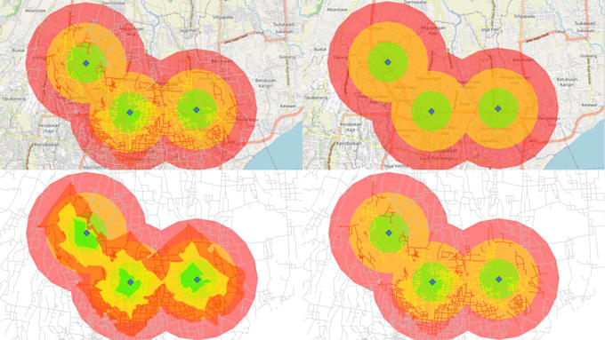
I provide GIS-based service area and accessibility analysis using network analysis and spatial tools. This service helps visualize how far people, services, or facilities can reach within a specific distance.
My analysis can be used for urban planning, logistics, accessibility studies, facility planning, and spatial research.
Services include:
Please send your data, location, and analysis requirements before ordering so I can recommend the best package.
Please inform the freelancer of any preferences or concerns regarding the use of AI tools in the completion and/or delivery of your order.
Urban Designer I Urban Planner I GIS Mapping and Cartographer
Languages
What is a service area or isochrone map?
A service area (isochrone) map shows how far a location can be reached within a certain distance using a road network.
What data do you need?
Please provide the location of the facility or points of interest, preferred distance, and the study area.