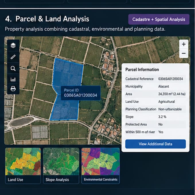
I will analyze parcel and land use analysis with gis

A
alexis_ba_
A
alexis_ba_
Alexis B

About this gig

Created a parcel-level GIS analysis combining cadastral, land-use, environmental and planning information. The workflow allows individual parcels to be evaluated based on location, area, land use, planning constraints and surrounding geographic conditions.

Get to know Alexis B

Alexis B

GIS Analyst ArcGIS Python

  • FromSpain
  • Member sinceSep 2026
  • Languages

    English, Spanish
Hi! I'm Alexis, a GIS Analyst and Programmer specializing in ArcGIS and geospatial data workflows. I work with ArcGIS Pro, Enterprise, Python/ArcPy, SQL, Oracle, LiDAR and FME. I help clients automate GIS workflows, troubleshoot ArcGIS issues, manage geospatial databases, process LiDAR and satellite data, and build web GIS solutions. I focus on practical solutions, reliable results and clear communication. Feel free to contact me before ordering to discuss your project.

My Portfolio

Related tags