Browse categories
Explore
Fiverr Pro
English
$
USD


I build Google Earth Engine workflows that turn the satellite archive into answers you can act on.
WHAT I CAN DO
WHAT YOU RECEIVE
WHY ME
Remote sensing engineer and PhD researcher at Capital Normal University, Beijing. 15+ government and private clients, including the Gilgit Development Authority and the Fisheries Department, Gilgit-Baltistan.
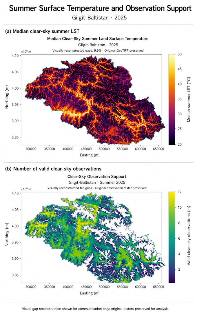
My LST work is in the gallery: median clear-sky summer temperature across Gilgit-Baltistan, shown with the count of valid observations behind every pixel, because a thermal map means little if you cannot see where data is thin.
Data: Landsat 5-9, Sentinel-1/2, MODIS, ERA5, CHIRPS, SRTM, ALOS.
Message me with your area of interest and what you need to decide.
Geospatial Data Scientist
Languages
What do you need from me to start?
Your area of interest (a shapefile, KML, or just coordinates or a place name), the date range, and what decision the result has to support. If you are unsure which index or dataset fits, describe the question and I will recommend the approach before you order.
Do I get the Earth Engine code, or only the maps?
You get the full commented script. It is yours to re-run, adapt and reuse on other areas. I explain the key steps so you can change dates, thresholds and study areas yourself without coming back to me.
Can you work on an area outside Pakistan?
Yes. Earth Engine is global, so I work anywhere with usable satellite coverage. Cloud cover and revisit frequency vary by region, so message me your area first and I will tell you honestly what the data can and cannot support.
