Browse categories
Explore
Fiverr Pro
English
$
USD


I turn a DEM and satellite imagery into the hydrology layers a project needs: where water collects, where it flows, and what is exposed.
WHAT I CAN DO
WHAT YOU RECEIVE
WHY ME
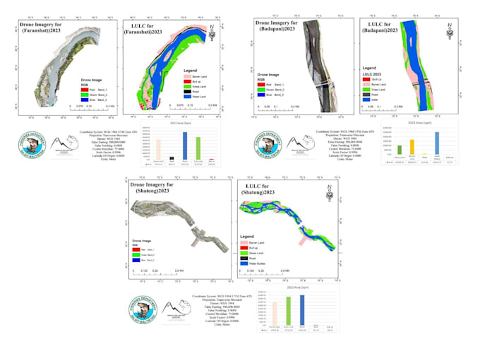
Remote sensing engineer and PhD researcher at Capital Normal University, Beijing. I led a three-river assessment for the Fisheries Department, Gilgit-Baltistan: watershed delineation from a 10 m DEM, land cover change 2000-2023, UAV survey at 4 cm, channel morphology and riparian buffers, delivered as eleven maps and a technical report. Examples are in the gallery.
Data: ALOS PALSAR and SRTM DEMs, Landsat, Sentinel-1/2, UAV imagery. Tools: ArcGIS, QGIS, Python.
Tell me your catchment or river reach and what you need to decide.
Geospatial Data Scientist
Languages
Do I need to supply the DEM?
No. I can source free DEMs such as SRTM 30 m, ALOS PALSAR 12.5 m or Copernicus 30 m. If you have LiDAR or a survey-grade DEM, send it and I will use that instead, since resolution drives how sharp the stream network comes out.
Is this hydraulic modelling, like HEC-RAS?
No, and it is worth being clear. This gig is GIS-based terrain and hydrology analysis: catchments, streams, buffers and susceptibility zoning. It does not produce hydraulic depth or velocity results. If you need a formal HEC-RAS inundation model, hire a hydraulic engineer.