Browse categories
Explore
Fiverr Pro
English
$
USD


_g3hddn.jpg)

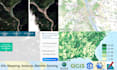
Hi, Welcome to my gig!
With 4+ years of professional experience in GIS mapping, Geomatics, Remote Sensing, and Spatial Analysis, I specialize in offering complete Geospatial Analysis and Mapping Services. Having expert command in tools including ArcGIS, QGIS, ArcGIS Pro, Google Maps, Erdas Imagine, Google Earth, Google Earth Engine, and Global Mapper, I can do any type of GIS Projects.
Services Offered
Why Choose Me
Let's connect to discuss your project in detail!
Full Stack Developer, GIS, React JS, Angular, Mapbox, ArcGIS and QGIS
Languages
How do you ensure data accuracy during digitization and georeferencing?
As explained in my intro video, I load basemap and apply swipe tool to check overlay/geo-referencing. For digitization accuracy check, I apply topology rules, validate topology, check error inspector and remove all the errors if occured during the digitization process.
Do you offer revision or correction services if I find errors in the output?
Yes, I would correct errors if found after the submission of work.
What formats can you deliver after digitization and georeferencing?
I can deliver in jpg, tiff, prg, dbf, shx, prj, shp, pdf, jgwx, jpg.aux.xml etc.
| (1) | ||
| (0) | ||
| (0) | ||
| (0) | ||
| (0) |
fati0000

France
Thanks for your cooperation to make the project alive! Highly recommended! Ali was patient and professional!
$50-$100
Price
6 days
Duration
| (1) | ||
| (0) | ||
| (0) | ||
| (0) | ||
| (0) |
fati0000
France
Thanks for your cooperation to make the project alive! Highly recommended! Ali was patient and professional!
$50-$100
Price
6 days
Duration


