Browse categories
Explore
Fiverr Pro
English
$
USD

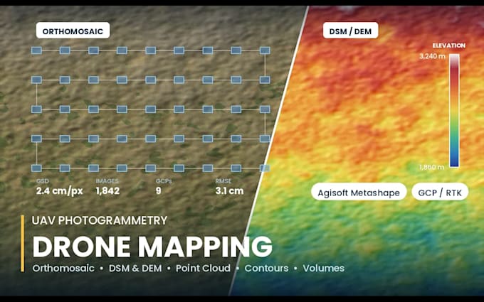
You flew the drone. I will turn the images into survey-grade deliverables.
I process UAV imagery in Agisoft Metashape and finish the outputs in ArcGIS Pro and QGIS. Background: mining, quarry, construction and terrain projects in high-relief mountain terrain.
DELIVERABLES
- Orthomosaic (GeoTIFF, tiled or full resolution)
- DSM and DEM (GeoTIFF)
- Dense point cloud (LAS / LAZ)
- 3D textured mesh (OBJ, PLY) and Sketchfab-ready model
- Contour lines at your interval (SHP / DXF / KML)
- Cut and fill and stockpile volume report with method and accuracy statement
- Processing report with GCP residuals and reprojection error
I WORK WITH
DJI (Phantom, Mavic, Mini, Matrice), Autel, WingtraOne and any geotagged JPG/TIFF set. GCP files in CSV, RTK/PPK logs, and oblique or nadir flights.
BEFORE YOU ORDER
Tell me: number of images, ground resolution or flight height, whether you have GCPs or RTK, and your required coordinate system. I will quote exactly and confirm feasibility, free.
Large datasets are welcome - send a Drive or WeTransfer link.
GIS Pro
Languages
What accuracy can I expect?
With good GCPs or RTK/PPK, typically 2-5 cm horizontal and 3-8 cm vertical. Without ground control, expect 1-3 m absolute accuracy but strong relative accuracy. I state measured residuals in the processing report.
How do I send hundreds of photos?
Google Drive, Dropbox or WeTransfer link in the order chat. No file size limit on my side.
Can you calculate stockpile or excavation volumes?
Yes. I provide volume above a fitted or user-defined base surface, with the method, base plane and confidence range documented.