Browse categories
Explore
Fiverr Pro
English
$
USD


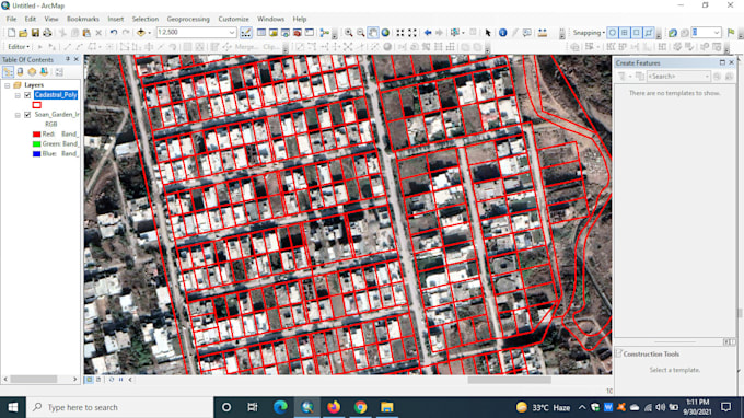
I am a graduate Geographer and Remote sensing and GIS analyst with more than 4 years of experience in the GIS field. I have done many projects from creating GIS maps by using ArcGIS and ERDAS IMAGIN software. I also have strong knowledge of database management and created more than 15 feature classes to digitize our map.
I will Design digital maps which are good to look at and depict the data in snapshots just for you. Also if you have any GIS assignments either in ArcGIS or ERDAS IMAGIN you are at the right place. I will do both ways of digitizing with georeferencing and without georeferencing.
I will import all geodatabase and help you visualize the map. The map will be print ready as per your dimensions. Hurry up let's start digitizing.
I will design, and implement systems and databases to access and store geospatial data. And create several feature classes.
Services:
GIS and Data Visualization Expert
Languages
How many features you going to create in digitize map?
It depends on your demand.