Browse categories
Explore
Fiverr Pro
English
$
USD

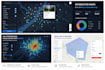
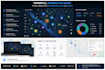
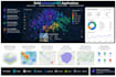
I will build a custom, responsive, and high-performance interactive map tailored to your business and technical requirements.
I can work with React, Deck.gl, Nebula.gl, React Map GL, Mapbox, Leaflet, OpenLayers, or another mapping library that best fits your project.
I can implement features such as markers, popups, clustering, custom layers, heatmaps, drawing and editing tools, filters, search, routes, geocoding, GeoJSON integration, real-time data, dashboards, and API connections.
I can also optimize large geospatial datasets and build smooth visualizations for thousands of points, polygons, or custom map layers.
Whether you need a simple map, an advanced GIS interface, or a complete geospatial web application, I will deliver a clean, scalable, and user-friendly solution.
Please contact me before ordering so we can review your data, features, preferred map provider, and project requirements.
What I can help you with:
Please be aware that it is against Fiverr's policies for sellers to include themes, templates, or any other elements that infringe third-party rights or applicable laws in the delivered work. Read more about in our Guide to Responsible Digital Creation.
Software Engineer
Languages
What information do you need before starting?
Please send your project requirements, preferred mapping technology, data format, required features, design references, API documentation, and access to the existing code if applicable.
Can you work with my preferred map library?
Yes. I can work with Mapbox, React Map GL, Deck.gl, Nebula.gl, Leaflet, OpenLayers, Google Maps, or another suitable mapping solution.
Which geospatial data formats do you support?
I can work with GeoJSON, JSON, CSV, KML, GPX, vector tiles, coordinates, and data provided through REST APIs or backend services.
Can you integrate the map into an existing application?
Yes. I can add new mapping features, fix existing issues, improve performance, or integrate an interactive map into your current React or web application.
Can you handle large geospatial datasets?
Yes. I can optimize rendering, clustering, filtering, loading, and visualization for large datasets. The final solution depends on the size and structure of your data.
Do you provide backend or API integration?
Yes. I can connect the map to REST APIs, databases, authentication systems, live data sources, or custom backend services.
Can you create drawing and editing tools?
Yes. I can implement tools for drawing, selecting, editing, and deleting points, lines, polygons, and other geographic objects.
Do I need to provide a Mapbox or Google Maps API key?
Yes, when the selected provider requires one. You should provide your own valid API key and billing account when applicable.


