Browse categories
Explore
Fiverr Pro
English
$
USD

Welcome to my Gig,
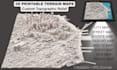
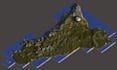
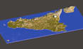
Looking for a custom 3D terrain map of a mountain, city, island, or any real location? I can turn your chosen area into a detailed 3D topographic relief model prepared for 3D printing.
I create custom terrain maps from location references, elevation data, and suitable map sources. Whether you need a mountain landscape, city relief map, hiking area, or a physical display model, I can help bring the terrain into 3D.
What I can create:
Custom 3D terrain and topographic relief maps
City maps and landscape models
STL files for 3D printing
Custom scale, base, and elevation detail
Optional roads, buildings, labels, and landmarks
OBJ source files and print ready model preparation
You can send a location, coordinates, map reference, or elevation file. I will review the project and confirm the details, size, and price before starting.
Please contact me with your location and what you want the final printed model to look like. I will be happy to discuss the best way to create it.
Please inform the freelancer of any preferences or concerns regarding the use of AI tools in the completion and/or delivery of your order.
Your Art Craft modeler
Languages
Can you create a 3D map of any location?
I can create models from suitable elevation data for many locations, including mountains, cities, islands, and landscapes. Send the location first so I can check the available data and confirm what can be modeled.
Can I send a Google Maps or Google Earth location?
Yes. You can send a location pin, coordinates, or a map reference. I will use it to identify the area and check the elevation data needed for the model.
Will the STL file be ready for 3D printing?
Yes, when the package includes STL. I will prepare the model as a solid printable object with an agreed base and dimensions. You should still check the file in your slicer before printing.
Can you make a city map with roads and buildings?
Yes, depending on the available data and the level of detail you need. Roads, buildings, landmarks, and labels can be added as optional features or included in a custom package.
Can you make a large map for my 3D printer?
Yes. Large terrain maps can be divided into smaller printable tiles. Send your printer's build volume and the final map size so I can plan the model properly.
Can you use my DEM, LiDAR, or elevation data?
Yes, if the data is suitable for the project. You can send a DEM, contour map, LiDAR derived surface, or other elevation file. I will review it and confirm the required format.
Can you add labels or names to the map?
Yes. You can request raised or engraved labels for locations, roads, mountains, or landmarks. The amount of labeling and the available space will affect the final price.
Can you make a model from a photo or screenshot?
A photo or screenshot can help with reference and shape, but accurate terrain usually needs elevation data. Send the image and location so I can check whether a suitable 3D model can be created.


