Browse categories
English
$
USD
Connect to your AI
GIS and Remote Sensing Expert for InSAR and Google Earth Engine
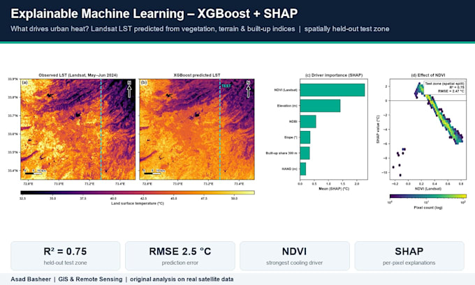
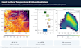
Machine learning for satellite and environmental data, done the way reviewers expect. I am a remote sensing PhD researcher at Tianjin University (MS CUG Wuhan) and build ML models for land cover, water, heat and hazard mapping. Example in my gallery: XGBoost + SHAP explaining urban land surface temperature (R2 0.75 on a spatially held-out test zone).
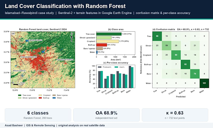
WHAT I DO: land cover / crop / forest classification (Random Forest, SVM, XGBoost, LightGBM); regression and prediction (water quality, chlorophyll-a, LST, air pollution, biomass, soil moisture, yield); explainable AI with SHAP and feature importance; spatial cross-validation (no data leakage); uncertainty maps and prediction intervals; accuracy assessment (OA, kappa, R2, RMSE).
DATA: Sentinel-1/2, Landsat, MODIS, VIIRS, GEDI, ERA5, in-situ and field data. Tools: Python (scikit-learn, XGBoost, SHAP, PyTorch), R, Google Earth Engine.
You get clean, commented code, maps and plots ready for a paper or report, and a short methods write-up. Message me with your data and goal first and I will suggest the right model.

Programming language:
Python
•
R
•
MATLAB
•
Colab
Frameworks:
Scikit-learn
•
Keras
•
PyTorch
•
Panda
Tools:
Jupyter Notebook
•
Excel
•
Colab
•
RStudio
Can I bring my own data?
Yes. Send your CSV, rasters or shapefiles. If you do not have data, I can build the dataset from free satellite archives.
Will the results be publishable?
I follow good practice for papers: spatial cross-validation, independent test sets, uncertainty and clear methods text. Many of my figures are from peer-reviewed work.