Browse categories
Explore
Fiverr Pro
English
$
USD


Welcome to my GIS and Remote Sensing Analysis service!
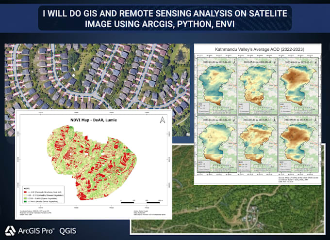
Im a Geomatics Engineer and GIS Analyst specializing in satellite image processing, spatial analysis and environmental monitoring using ArcGIS Pro, ArcGIS, QGIS, ENVI and Python. I transform raw geospatial data into accurate, meaningful insights and create visually appealing maps for research, planning and decision-making.
Services I Offer:
Why Choose Me
Let's use Earth Observation and GIS analytics to uncover meaningful insights from your satellite imagery. Message me to get started!
Languages
1. What type of satellite images can you work with?
I can process imagery from Sentinel, Landsat, MODIS and other commercial or open-source datasets. I also work with drone imagery and custom raster datasets for analysis and mapping.
2. What kind of analyses can you perform on satellite images?
I perform land use/land cover classification, NDVI and other index mapping, change detection, time-series analysis, urban growth analysis and environmental parameter estimation (e.g., LST, AOD, PM2.5).
3. Which software and tools do you use?
I use ArcGIS, ArcGIS Pro, QGIS, ENVI, Google Earth Engine and Python (with libraries like Rasterio, NumPy, scikit-learn) to process and analyze geospatial and remote sensing data accurately.
4. What output formats will I receive?
You can receive outputs in GeoTIFF, SHP, KML, GeoJSON, PDF, PNG, or JPG formats, along with clear map layouts, legends and metadata ready for publication or reporting.
5. Can you help with classification and accuracy assessment?
Yes! I perform both supervised and unsupervised classification, including Random Forest, Maximum Likelihood, or SVM, and provide accuracy assessment reports (confusion matrix, kappa coefficient).
6. Can you analyze multiple time periods for change detection?
Of course! I can process and compare multi-temporal satellite images to map land use/cover changes, vegetation loss, or urban expansion across years or seasons.
7. Can you integrate ground or in-situ data with satellite imagery?
Yes. I can integrate ground survey, GNSS, or sensor data with remote sensing datasets to improve model accuracy and validation.