Browse categories
Explore
Fiverr Pro
English
$
USD


Hello, I'm Ashok
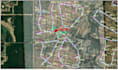
I am a geospatial professional specializing in GIS, remote sensing, UAV, and LiDAR data processing, delivering accurate, analysis-ready outputs for mapping and decision-making.
If you need professional support in GIS, digitization, and remote sensing, feel free to reach out to me.
Services I Offer
I ensure accurate, clean, and well-structured outputs suitable for research, planning, and professional use.
Please contact me before placing an order so we can discuss your requirements in detail. I'm happy to customize packages and provide tailored offers based on your project needs.
Looking forward to working with you!
Cheers,
Ashok
Geomatics Engineer | GIS & Remote Sensing Specialist
Geomatics Engineer
Languages


