Browse categories
Explore
Fiverr Pro
English
$
USD

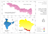
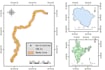

Welcome to my GIS Mapping Service!
I am a Civil Engineer with experience in ArcGIS, QGIS, spatial analysis, and cartographic map design.
I can help you with:
GIS Mapping
ArcGIS Projects
QGIS Projects
Georeferencing Maps
Digitization of Roads, Buildings, and Parcels
Land Use/Land Cover Mapping
Watershed Mapping
Shapefile Editing
KML, GeoJSON, and GIS Data Conversion
Professional Map Layout Design
Deliverables:
Why choose me?
Please contact me before placing an order to discuss your project requirements.
Civil Engineer, AutoCAD and GIS Expert
Languages
What GIS software do you use?
I primarily use ArcGIS, QGIS and Google Earth Engine for mapping, spatial analysis, georeferencing, digitization, and cartographic design.
What file formats can you work with?
I can work with Shapefiles (SHP), KML, KMZ, GeoJSON, CSV, Excel, DEM, raster data, and other common GIS formats.
What deliverables will I receive?
Depending on your requirements, I can provide PDF maps, PNG/JPG images, Shapefiles, Geodatabases, GeoJSON files, and source project files.
Can you digitize maps, roads, buildings, and land parcels?
Yes. I can accurately digitize roads, buildings, boundaries, parcels, and other geographic features from maps, satellite imagery, or scanned documents.
Do I need to provide GIS data?
If you already have GIS data, please upload it. If not, contact me first and I will discuss possible data sources and project requirements.
Can you create professional map layouts for reports and presentations?
Yes. I can design publication-quality maps with legends, scale bars, north arrows, labels, and professional layouts suitable for reports, research, and presentations.
Can you perform spatial analysis?
Yes. I can perform basic to intermediate GIS analyses such as buffering, overlay analysis, proximity analysis, watershed mapping, terrain analysis, and thematic mapping.
Should I contact you before placing an order?
Yes. Please contact me before placing an order so I can understand your requirements and recommend the most suitable package.


