Browse categories
Explore
Fiverr Pro
English
$
USD

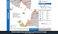


A good map is read in seconds and trusted for years.
I am a certified GISP and have designed maps and atlases for nearly 20 years, for the United Nations, the World Bank and national agencies: from an earthquake response atlas to a province-by-province infographic book for disaster preparedness.
What I can design:
- Thematic maps for reports, publications and presentations
- Location, reference and study area maps
- Map series and atlas pages that share one style
- Infographic maps that combine a map, charts and key numbers
- Large-format posters, and field maps as GeoPDF
- Redesigns of maps that are cluttered or hard to read
Example uses: report figures, project briefs, donor proposals, emergency response, wall posters.
How I work:
- You send the data, or describe what the map must show; open data can be compiled
- I share a draft layout and style before finishing
- Clear hierarchy, readable labels, colour-blind friendly colours, proper legend, scale and sources
You receive high-resolution PNG and PDF. Higher packages add editable QGIS or ArcGIS projects and a reusable template.
Every project differs in data, method and output, so message me for a custom offer.
5t
Exploring Climate with GIS and Data Science
Languages
What do you need from me to make a map?
Your data, such as a shapefile, GeoPackage, GeoTIFF, KML or CSV with coordinates, or a clear description of what the map must show. A sketch, an example you like, or your style guide helps too.
I have no GIS data. Can you still make my map?
Yes. I can compile open data such as administrative boundaries, roads, rivers, settlements, elevation and satellite basemaps. Add the data compilation extra, or message me to check coverage for your area.
Which package should I choose?
Basic for one map. Standard for a small set in one style, such as the figures for a report. Premium for an atlas or map series built on a template you can reuse.
Are the package prices fixed?
No, they are a starting point. The real scope depends on your data, the method and the outputs you need. Message me with the details and I will send a custom offer that fits your project.
Can you follow my organisation's style or branding?
Yes. Send your style guide, fonts, colours or logo and I will build the layout around them. If you have none, I will propose a clean, neutral style.
Which sizes, formats and software do you use?
From slide and A4 up to A0 posters, as PNG, JPG, PDF or SVG at print resolution, plus GeoPDF for field apps. Maps are made in QGIS or ArcGIS Pro and finished in Inkscape or Illustrator.
Is my data kept confidential?
Your data is used only for your order and is never shared. If you ask, I delete it after delivery.


