Browse categories
Explore
Fiverr Pro
English
$
USD
GIS Analyst, Civil Engineer, CAD, Civil 3D, ETABS, BIM, Adobe Premiere Pro
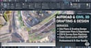
Most CAD gigs give you lines on a screen with less precision. I can give you drawings you can actually build from.
⭐⭐⭐⭐⭐
I've delivered a 5-star subdivision plat project (20-120 lots, USA) using
AutoCAD and Allplan, and I work directly from Total Station CSV
exports and field-book transcriptions not just PDF traces or rough
sketches.
What I do:
Who this is for: land developers, small civil/engineering firms, and
surveyors who need drawings structured for real construction use not
just a rendering.
Files are organized and labeled for handoff to your team. Send me your
survey data or boundary description and I'll confirm the right package
and turnaround.
Project scale:
House
Building type:
Residential
•
Office & workspace
•
Infrastructure
Material speciality:
Concrete
•
Steel
Please inform the freelancer of any preferences or concerns regarding the use of AI tools in the completion and/or delivery of your order.
What file formats can you start from?
Total Station CSV exports, PDF, hand sketches, existing DWG files, or GPS/point data; send whatever you have.
Do you handle grading and drainage design, or just drafting?
Both, Standard and Premium include Civil 3D surface generation, grading, and drainage/road alignment, not just line drafting.
What if my project is larger than the listed packages?
Send me your scope and I'll provide a custom quote.
Can you match my jurisdiction's setback/zoning conventions?
Tell me the jurisdiction and applicable code, and I'll confirm before starting.
Which software version do you work in?
Current AutoCAD/Civil 3D, with backward-compatible DWG exports on request.


