I will do onscreen digitization from satellite images

Bangladesh

I speak English

4 orders completed

Hello! I am Md. Shahidul Islam, a GIS professional with a strong background in RS, GIS, Python, and ML. Having worked as a consultant in UNDP, USAID, LGED and University of Dhaka, I bring a unique ble...
About this Gig

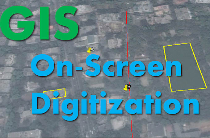
Title: Professional Digitization of Satellite Images for Precise Data Analysis


Are you looking to transform satellite imagery into actionable data for your projects? I offer high-quality digitization of satellite images for various applications.


As a Remote Sensing, GIS, specialist, I have extensive experience in extracting accurate information from satellite images. My services cover:

  • Digitization of satellite imagery (e.g., converting raster data into vector formats)
  • Feature extraction (roads, buildings, land use patterns, water bodies, etc.)


Why Choose Me:

  • Proven expertise in Remote Sensing, GIS
  • Extensive experience working with a wide range of satellite data
  • Use of industry-standard tools like ArcGIS, QGIS, ENVI, and Python libraries
  • Fast delivery with high accuracy and attention to detail


Ideal for:

  • Researchers and scientists
  • Urban planners and developers
  • Geospatial analysts


Let's turn your satellite images into meaningful insights! Feel free to contact me before placing an order to discuss your specific requirements.


Delivery Format: Shapefiles, KML, or other preferred formats


Order now and lets elevate your geospatial data with professional digitization services!

Convert from:

Other

Convert to:

Other