Browse categories
Explore
Fiverr Pro
English
$
USD

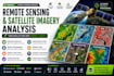
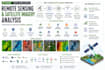
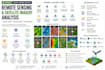
Need professional remote sensing, satellite imagery analysis, or Google Earth Engine (GEE) support?
I provide end-to-end satellite and geospatial analysis using Sentinel, Landsat, DEM and other Earth observation data for research, business, planning and environmental applications.
Services include:
I work with Google Earth Engine, ArcGIS, QGIS, Python, Sentinel, Landsat, GDAL, Rasterio and GeoPandas.
You will receive clear, professional maps, analysis and GIS-ready outputs tailored to your project.
Please message me for large areas, long time-series or custom analysis.
GIS Developer
Languages
What satellite imagery can you work with?
I can work with Sentinel, Landsat and many other satellite, aerial, DEM and Earth observation datasets depending on your project and required resolution.
Can you perform NDVI, NDWI, NDBI and other spectral index analysis?
Yes. I can calculate and analyze vegetation, water, built-up and other relevant spectral indices and provide professional maps and GIS-ready results.
Can you perform land-use and land-cover classification?
Yes. I can provide land-cover mapping and classification workflows depending on the imagery, study area, classes and accuracy requirements.
Can you perform satellite change detection?
Yes. I can compare imagery from different dates to analyze urban growth, vegetation change, land-cover change, water changes and other spatial patterns.
Do you work with Google Earth Engine?
Yes. I can develop Google Earth Engine workflows for satellite processing, spectral indices, classification, time-series analysis, environmental monitoring and large-area analysis.
Can you analyze an entire city, region or country?
Yes, depending on the required analysis and dataset. Large areas or long time-series may require a custom offer, so please message me before ordering.
What files will I receive?
Depending on the project, deliverables can include GeoTIFF, Shapefile, GeoJSON, GeoPackage, KML/KMZ, CSV/Excel, high-resolution maps and other GIS-ready outputs.
Can you handle a remote sensing task that isn't listed?
Absolutely. Send me your study area, objective and available data. I can assess the requirements and recommend an appropriate remote sensing workflow.


