Browse categories
Explore
Fiverr Pro
English
$
USD

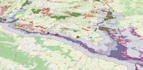


We are happy to bring more than a decade of PhD-level experience in web mapping, virtual globes, and GIS to your organization!
Delivery times are approximations, we will calculate it based on your exact needs.
Our workflow is agile, we will always keep you in the loop. Sprint lengths are usually 1-2 weeks depending on the complexity of the project.
Using advanced spatial visualization techniques (e.g. 3D BIM with Cesium JS) is possible, but costs extra. Please let us survey your requirements before placing an order.
The off-the-shelf backend in the standard tier is usually GeoServer, but other standard geospatial server technologies can be arranged on demand. Our preferred spatial database is PostGIS, although we are flexible on that one as well.
Geospatial ETL workflows are exclusive to premium tier applications.
CAD Automation, Web GIS Solutions
Languages


