Browse categories
Explore
Fiverr Pro
English
$
USD

Planetary Scientist, GIS, Technical and Scientific Writing
Skills
See my services
University of North Dakota
9 mos
North Dakota Space Grant Fellow
Jun 2024 - Dec 2024 • 6 mos
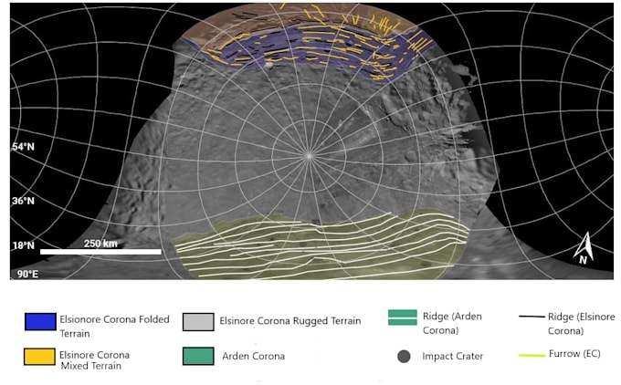
• Used ArcGIS Pro and JMARS edit, process, and clean geospatial data to create distribution maps of 22 ice-rich mud domes on the dwarf planet (1) Ceres and applied statistical analysis tools (Excel) to analyze correlations within the data • Analyzed dome age and viscosity data using statistical correlation tools (Excel) and found support for varying ice content across domes, supporting scientific investigations and future data analysis, and documented results in conference abstracts (2024)
Intern at Jet Propulsion Laboratory
Jan 2024 - Apr 2024 • 3 mos
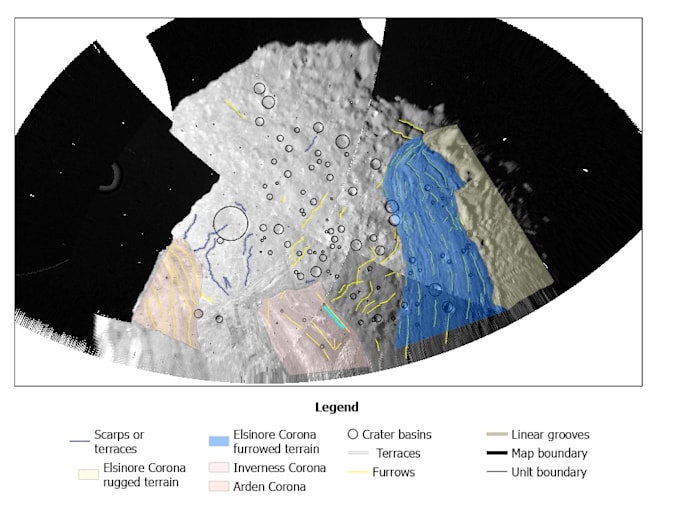
• Used ArcGIS Pro to create new maps of ~100 linear surface features (ridges and canyons), and identified previous undiscovered patterns in feature distribution based on numerical modeling analysis of satellite data • Used python-based numerical modeling software (SatStressGUI) to create surface geophysical models and validated models with observed distribution of features, identifying possible formation mechanisms, and documented results in two technical papers (2024, 2025)
Intern at Jet Propulsion Laboratory
ANRE Technologies
Jun 2022 - Dec 2023 • 1 yr 6 mos
• Used ArcGIS Pro to create new maps of ~100 linear surface features (ridges and canyons), and identified previous undiscovered patterns in feature distribution based on numerical modeling analysis of satellite data • Used python-based numerical modeling software (SatStressGUI) to create surface geophysical models and validated models with observed distribution of features, identifying possible formation mechanisms, and documented results in two technical papers (2024, 2025)
