I will work using geographic information systems gis

C
cami_silva
C
cami_silva
cami_silva

About this gig

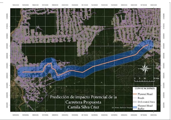
I will create accurate and visually appealing maps using GIS tools for your project, report, or presentation. This includes spatial data processing, cartographic design, and map export in high quality formats.

Get to know cami_silva

cami_silva

Your data, my maps: clear, accurate, and professional

  • FromColombia
  • Member sinceApr 2021
  • Avg. response time7 hours
  • Languages

    Spanish
Hello, my name is Camila Silva, I´m from Colombia, I am an Environmental Engineer specialized in Geographic Information Systems (GIS). I work with tools such as ArcGIS, QGIS, ENVI, and Google Earth. I have experience downloading and processing satellite imagery, obtaining data from various satellites and specialized sources, and transforming it into clear and accurate cartographic representations. My work combines technical precision with environmental analysis to deliver high-quality geospatial products.

Related tags