I will do gis mapping, remote sensing analysis and spatial data processing

C
chris__miller
C
chris__miller
Chris.M

About this gig

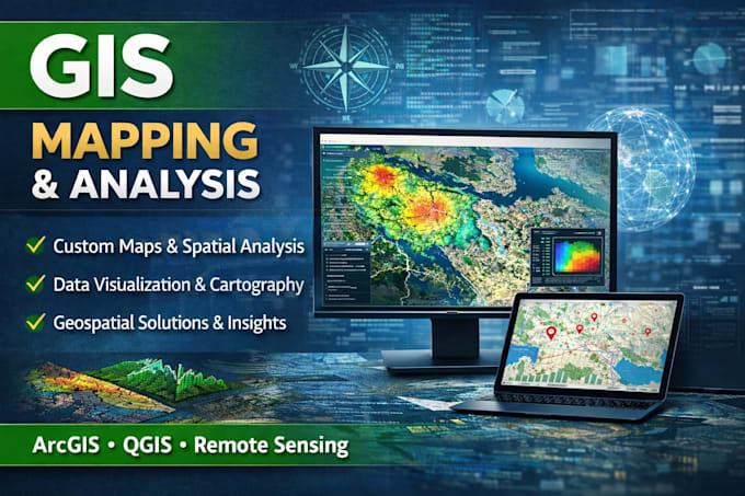
Are you looking for accurate GIS mapping, remote sensing analysis, or spatial data processing?


I provide professional geospatial solutions designed to turn complex data into clear, actionable insights for your projects.


GIS Mapping & Spatial Analysis

  • Creation of high quality, customized maps
  • Spatial data analysis and geoprocessing
  • Georeferencing, digitization, and map layout design


Remote Sensing Analysis

  • Satellite imagery processing (Landsat, Sentinel)
  • Land Use/Land Cover (LULC) classification
  • NDVI and change detection analysis


Spatial Data Processing

  • Raster and vector data analysis
  • Terrain and elevation modeling (DEM, contours)
  • Data cleaning, conversion, and database management


Why Choose This Service?

  • Accurate and detail oriented results
  • Fast delivery and clear communication
  • Solutions tailored to your project needs


Using tools like ArcGIS, QGIS, and Google Earth Engine, I ensure reliable, high quality outputs.


Contact me before placing your order to discuss your project requirements and achieve the best results.


Get to know Chris.M

Chris.M

GIS Mapping And Spatial Data Analysis Expert

  • FromUnited States
  • Member sinceApr 2026
  • Avg. response time1 hour
  • Languages

    English
I am a GIS specialist skilled in creating custom maps, spatial analysis, and geospatial visualizations using QGIS, ArcGIS, and Python. I transform complex spatial data into clear, accurate, and visually appealing maps tailored to your needs. My services include thematic mapping, data processing, and geospatial analysis for businesses, research, and planning. I focus on delivering high quality, precise, and easy to understand GIS solutions to support better decision making.