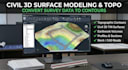
I will convert survey data into civil 3d topographic surface model

C
civiflowjoe
C
civiflowjoe
Joe

About this gig

Professional Civil 3D surface modeling, topographic contour map drafting, point cloud processing, and earthwork volume calculation services for surveyors, architects, engineers, and land developers.


Services Offered:

  1. - Civil 3D surface creation from field survey points, GPS data, drone LIDAR, CSV, or elevation sketches.
  2. - Existing and proposed topography contours, slope analysis, catchment basin boundary, and spot elevation modeling.
  3. - Earthwork cut and fill volume calculations, TIN surface editing, and site grading alignment profiles.
  4. - 3D surface mesh export for Revit, SketchUp, Civil 3D, and AutoCAD integration.
  5. - Road alignment profiles, cross sections, site utility layout, and pipe network 3D surface overlay.


Deliverables:

- Source AutoCAD Civil 3D file (.DWG format).

- High-resolution topographic PDF drawing with scale and contour labels.

- Earthwork cut and fill quantity report (CSV or PDF).


Ideal for civil engineers, survey teams, land developers, and architectural site modeling. Contact me before ordering with your raw point data or survey file.


Delivery style preference

Please inform the freelancer of any preferences or concerns regarding the use of AI tools in the completion and/or delivery of your order.

Get to know Joe

Joe

Civil Engineer specializing in residential stormwater drainage, grading

  • FromUnited States
  • Member sinceAug 2026
  • Avg. response time1 hour
  • Languages

    English
Hi, I’m Joe, a Civil Engineer specializing in residential stormwater drainage, grading, and site development design. I help homeowners, builders, and property owners solve drainage problems, manage stormwater runoff, improve yard drainage, and prepare residential grading and drainage plans. My services include stormwater drainage design, grading plans, site plans, hydrology and hydraulic calculations, drainage layouts, detention design, and Civil 3D drawings. Send me your property survey, site plan, or project requirements to get started.