Browse categories
Explore
Fiverr Pro
English
$
USD

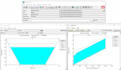

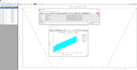
I will provide professional 1D and 2D hydraulic modeling using HEC-RAS for rivers, channels, floodplains, bridges, culverts and flood studies.
My services include HEC-RAS model setup, terrain and geometry preparation, boundary conditions, steady/unsteady flow simulations, water surface profiles, flood depth, velocity analysis and flood inundation mapping.
Services include:
HEC-RAS 1D hydraulic modeling
HEC-RAS 2D hydraulic modeling
Flood modeling and inundation mapping
River and channel analysis
Bridge and culvert modeling
Water surface elevation analysis
Flood depth and velocity maps
GIS-based hydraulic results
Model results and technical report
Please contact me before ordering if your project requires a customized scope.
Please inform the freelancer of any preferences or concerns regarding the use of AI tools in the completion and/or delivery of your order.
Lecturer
Languages
What information do you need to start the HEC-RAS modeling?
I typically need a DEM/terrain file, river or channel geometry, cross-sections if available, flow data, boundary conditions, bridge/culvert details, and any relevant survey or GIS data.
Can you create both 1D and 2D HEC-RAS models?
Yes. I can develop HEC-RAS 1D, 2D, or combined 1D/2D models depending on your project requirements and available data.
Can you provide flood inundation, depth, and velocity maps?
Yes. I can process HEC-RAS results and prepare GIS-based flood extent, depth, velocity, and water surface elevation maps.
Can you model bridges and culverts in HEC-RAS?
Yes. I can incorporate bridges, culverts, roadway crossings, and other hydraulic structures into the HEC-RAS model and analyze their hydraulic performance.
Can you provide a technical report with the model results?
Yes. I can provide model results and a technical report summarizing the methodology, input data, simulations, water surface elevations, flood depths, velocities, and key findings.


