Browse categories
Explore
Fiverr Pro
English
$
USD


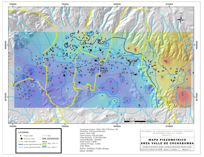
Are you looking for accurate, professional geological or thematic maps for your project?
I am a geologist and GIS specialist with 5+ years of experience working for SERGEOMIN (Bolivia's national geological survey). I produce high-quality maps and spatial analysis using ArcGIS, QGIS, ENVI, and Google Earth Engine.
WHAT YOU GET:
WHY CHOOSE ME:
Just send me your data and area of interest I will take care of the rest.
GIS Analyst and Geologist, ArcGIS ENVI Drone Photogrammetry
Languages
What data do I need to provide
Just share your area of interest (coordinates, shapefile, or a map) and any data you have (elevation, satellite images, field data). I can also work with publicly available data if you don't have any.
What file formats will I receive?
You will receive PNG and PDF print-ready files. Shapefiles and GeoTIFF are included in Standard and Premium packages.
Can you work with my specific study area?
Yes, I work with any location worldwide. I have experience with projects in Bolivia, Peru, and across Latin America, but can process data from any region.