Browse categories
Explore
Fiverr Pro
English
$
USD


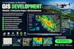
Need a professional GIS web application, interactive map, or geospatial dashboard for your business or project?
I will develop custom WebGIS applications, interactive maps, GIS dashboards, and digital mapping solutions tailored to your requirements.
WHAT I CAN DEVELOP
WHO CAN BENEFIT?
Real estate businesses, logistics companies, urban planners, environmental researchers, surveyors, agriculture businesses, and organizations working with geographic data
WHY WORK WITH ME?
Need a custom GIS map, WebGIS app, or geospatial dashboard?
Message me to discuss your project before ordering!
GIS Development, GIS Analysis, Cartography, Web Mapping
Languages
What GIS development services do you offer?
I develop custom GIS web applications, WebGIS platforms, interactive maps, digital mapping solutions, geospatial dashboards, and location-based applications.
Can you build a custom WebGIS application or GIS dashboard?
Yes! I can build responsive WebGIS applications and GIS dashboards with interactive map layers, spatial data visualization, location filters, and custom features.
Which GIS mapping tools and technologies do you use?
Depending on your project, I can work with Leaflet, Mapbox, Google Maps API, PostGIS, and other suitable geospatial technologies.
Can you integrate drone mapping data into a GIS web application?
Yes, I can help integrate and visualize compatible drone mapping data, aerial imagery, and geospatial datasets in your GIS application.
What do you need to start my GIS web development project?
Please share your project requirements, preferred mapping tools, sample datasets, reference designs, and required features. Message me before ordering to discuss the best package for your project.
Can you add real-time data to WebGIS apps?
Absolutely! I can integrate live data via APIs or sensors for real-time updates.
Can you create interactive web maps for my website?
Yes, I can build embeddable web maps using Leaflet, Mapbox, or ArcGIS Online.
