Browse categories
Explore
Fiverr Pro
English
$
USD


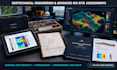
Are complex spatial datasets and strict regulatory requirements holding up your development project? Incomplete technical documentation, inaccurate slope or subsurface evaluations, and poor spatial modeling can lead to costly delays and compliance rejection.
I deliver high-precision geotechnical engineering, environmental impact, and enterprise gis mapping reports tailored for developers, energy firms, and consulting teams. Combining advanced spatial modeling with rigorous data interpretation, every deliverable is engineered to meet strict corporate and regulatory standards.
What I Offer:
Why Work With Me?
Ready to move your project forward? Message me now to discuss your project scope.
Keywords: geotechnical, environmental impact, gis mapping, geology, hydrogeology, ArcGIS, QGIS, site assessment, mining, spatial analysis.
Senior Geologist and GIS Lead, Enterprise Geotechnical Spatial Analysis
Languages
Can you work with customized field data, borehole logs, or specialized GIS layers?
Yes. I process complex shapefiles, raster overlays, borehole data, and CSV points directly in ArcGIS Pro or QGIS to produce precise geotechnical and site assessment outputs.
Are these reports suitable for corporate stakeholders, investors, or municipal filings?
Absolutely. Every deliverable is structured with professional formatting, technical citations, executive summaries, and high-resolution spatial maps suitable for commercial and regulatory review.
