Browse categories
Explore
Fiverr Pro
English
$
USD

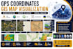
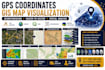
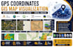
Need accurate GIS maps from GPS points, scanned maps, or raster images?
Missing coordinates, poor georeferencing, or outdated maps can delay your project and reduce accuracy.
I convert GPS coordinates, raster maps, and survey data into professional GIS maps, vector layers, and georeferenced files using ArcGIS and QGIS for engineering, environmental, planning, and research projects.
Here's what my service includes:
Platforms I work with:
ArcGIS Pro · ArcMap · QGIS · Google Earth Pro · AutoCAD Map 3D · Global Mapper · ERDAS Imagine · ENVI · GPS Visualizer · OpenStreetMap · Google Maps · Bing Maps · Mapbox · CARTO · GeoServer · PostGIS · GeoJSON · KML · KMZ · Shapefile
Poorly referenced maps and inaccurate GIS data can lead to costly project errors, incorrect decisions, and repeated fieldwork.
SELECT A PACKAGE TO START IMMEDIATELY OR MESSAGE ME FOR A CUSTOM QUOTE.
GIS and ArcGIS Expert
Languages
Can you convert GPS coordinates into GIS maps?
I transform latitude/longitude coordinates into accurate GIS maps with shapefiles, KML, GeoJSON, or other formats ready for analysis, reporting, and presentations.
Do you work with surveyors and engineers?
Yes. I support surveyors, engineers, environmental consultants, researchers, municipalities, construction firms, and planning professionals.
Why should I choose the Premium package?
Premium includes advanced georeferencing, raster digitization, spatial analysis, multiple export formats, editable GIS projects, and priority support.
What GIS formats do you deliver?
I provide SHP, GeoJSON, KML, KMZ, DXF, DWG, PDF, TIFF, GeoTIFF, CSV, and ArcGIS/QGIS project files where required.
Can you georeference scanned maps?
Yes. I accurately georeference scanned maps, engineering drawings, aerial images, and historical maps for GIS use.
Can you digitize raster maps?
Yes. I convert raster images into clean vector GIS layers with polygons, lines, and point features.
Do you perform spatial analysis?
Yes. I perform buffer analysis, overlays, proximity analysis, hotspot mapping, density mapping, and spatial queries.
Can you clean GIS datasets?
Yes. I correct topology issues, remove duplicate features, update attributes, and improve data quality.
Is my GIS project confidential?
Absolutely. All project files remain confidential and are never shared with third parties.
Can you deliver editable GIS files?
Yes. Editable ArcGIS Pro, ArcMap, and QGIS project files are available based on your selected package.


