Browse categories
Explore
Fiverr Pro
English
$
USD



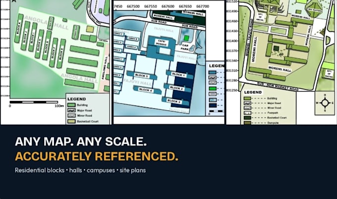
I will georeference scanned or raster maps into accurate coordinate systems using Golden Software Surfer. You'll get a clean, exportable base map ready to drop into your report, GIS project, or proposal with correct spatial referencing you can trust.
Tags: georeferencing, GIS, coordinate system, spatial mapping, cartography, Golden Surfer Software
Bold ideas, brilliant results
Languages
What file formats do you accept for the source map/image?
JPG, PNG, TIFF, or PDF scans. Higher resolution gives more accurate results.
What coordinate systems can you work with?
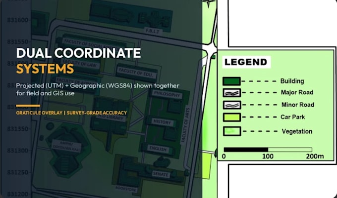
I can georeference to WGS84, UTM, or your specified projected coordinate system. I can also display dual coordinate systems (projected + WGS84) on a single map if needed.
Do I need to provide reference points, or can you find them?
If your map has visible landmarks, roads, or known coordinates, I can use those. If not, please provide at least 3-4 reference points with known coordinates for accuracy.
What software do you use?
Golden Software Surfer, for precise, professional-grade output.
Can you handle maps with no clear reference points at all?
This is harder and may affect accuracy — message me first with your file so I can confirm feasibility before you order.