Browse categories
Explore
Fiverr Pro
English
$
USD



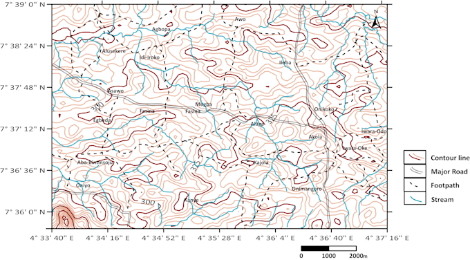
I turn your provided map area, or raw elevation, or survey data into clean, presentation-ready topographic and contour maps using Golden Software Surfer suitable for site reports, exploration documentation, and academic or engineering use.
Tags: Topography, Maps, Google Maps, Elevation, Data, Contour, Mapping, GIS, Golden Surfer Software
Bold ideas, brilliant results
Languages
What data do I need to provide?
Elevation/survey data (XYZ points, spot heights, or a grid file). If you only have a scanned topo map, use my georeferencing gig first.
Can you customize colors, contour intervals, or labels?
Yes — this is included from the Standard package upward.
What format will I receive the final map in?
High-resolution PDF by default. I can also provide PNG or other formats on request.
Can you add a scale bar, north arrow, and legend?
Yes, included in all packages as standard cartographic elements.
Do you work with sparse or low-quality datasets?
I can, but very sparse data affects contour accuracy. Message me your dataset first if you're unsure.