Browse categories
Explore
Fiverr Pro
English
$
USD
Software Engineer, BIM Automation, CAD Development, WebApp
Applications
Point cloud and LiDAR scans capture precise spatial data, but raw datasets alone are not enough for engineering decisions. Converting E57 or similar scan files into measurable, validated geometry requires structured analysis and careful processing.
This service focuses on analyzing point cloud geometry and LiDAR E57 datasets to extract accurate measurements, validate spatial alignment, and perform structured 3D inspection workflows. The goal is to transform raw scan data into dependable outputs suitable for engineering review, construction validation, infrastructure inspection, or quality control.
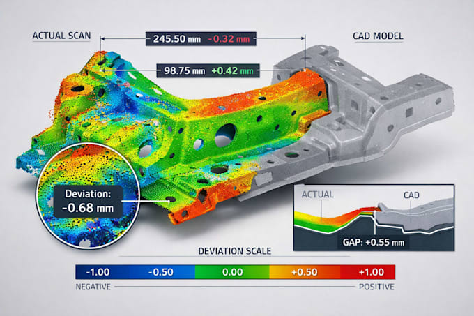
Workflows may include distance, area, and volume measurement, deviation analysis against reference models, grading checks, surface validation, and geometric comparison between scan and design intent. Large datasets are processed with attention to performance and clarity, ensuring results remain reliable and consistent.