Browse categories
Explore
Fiverr Pro
English
$
USD
Civil Engineer Stormwater Drainage Grading Land Development
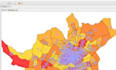
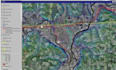
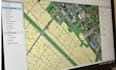
I provide professional GIS mapping and spatial analysis using ArcGIS Pro, ArcMap and QGIS for civil engineering, land development, planning, property, environmental, research and development projects.
My services include GIS mapping, spatial analysis, ArcGIS mapping, QGIS mapping, parcel mapping, land-use mapping, digitization, georeferencing, terrain analysis, proximity analysis, buffer analysis, overlay analysis, location analysis, GIS data processing and cartographic map creation.
I can work with Shapefile, GeoJSON, KML/KMZ, CSV, Excel, CAD files, raster data, satellite imagery, PDFs and existing GIS projects. I can organize geographic data, create professional map layouts, analyze spatial relationships and present results clearly.
Services include:
Whether you need a property map, land-use map, site analysis, infrastructure map, geographic data visualization or customized GIS project, I can help.
Project scale:
Building
Building type:
Residential
•
Commercial
•
Industrial
Material speciality:
Concrete
•
Steel
Please inform the freelancer of any preferences or concerns regarding the use of AI tools in the completion and/or delivery of your order.
Which GIS software do you use?
I work with ArcGIS Pro, ArcMap and QGIS depending on the requirements of the project.
What GIS files can you work with?
I can work with Shapefiles, GeoJSON, KML/KMZ, CSV, Excel, CAD, raster data, satellite imagery, PDFs and existing GIS projects.
Can you perform spatial analysis?
Yes. I can perform suitable buffer, overlay, proximity, location, terrain and other spatial analysis based on the project objective.
Can you create GIS maps for civil engineering projects?
Yes. GIS can be used for land development, infrastructure, property, environmental and civil engineering-related mapping and analysis.


