Browse categories
Explore
Fiverr Pro
English
$
USD


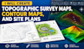
Need professional topographic survey maps, contour drawings, or detailed site plans for your project?
I provide accurate and well-organized topographic mapping and CAD drafting services for civil engineering firms, architects, contractors, land developers, and property professionals.
Using your existing survey data, coordinates, elevation points, and project requirements, I can help transform technical information into clear, detailed, and editable drawings suitable
for design coordination and project planning.
MY SERVICES INCLUDE:
Whether you need a topographic map for site development, contour drawings for engineering design, or survey data converted into CAD format, I can help prepare drawings based on the information you provide.
Contact me before Ordering to confirm your project scope, survey data, and file format.
Please inform the freelancer of any preferences or concerns regarding the use of AI tools in the completion and/or delivery of your order.
US Land Surveyor
Languages
What do you need to start a topographic mapping project?
I need your available survey data, coordinates, elevation points, project boundary, preferred units, required drawing format, and any applicable drafting standards.
Can you create contour maps from CSV or Excel data?
Yes, if the file contains suitable coordinate and elevation information. I will review the data before confirming the scope.
Can you work with US survey units?
Yes, provided the required units, coordinate reference system, datum, and project specifications are supplied and supported by the available data.
Can you revise the drawing?
Yes. Each package includes a stated number of revisions for changes within the original agreed scope.
