Browse categories
Explore
Fiverr Pro
English
$
USD

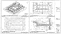
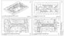
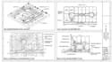
WELCOME TO MY GIG:
I provide professional 3D subdivision site plans, lot layouts, terrain modeling, land development concepts, and site visualization for residential, commercial, and mixed-use projects. I transform survey data, CAD drawings, topographic information, sketches, and existing site plans into detailed and visually clear 3D site models.
WELCOME TO MY GIG:
Subdivision & Lot Planning
Terrain & Site Modeling
3D Site Visualization
Send your site details today and lets create your professional 3D development plan.
Fiverr does not screen freelancers in this category. Please verify qualifications and discuss requirements with the freelancer before ordering, including any preferences regarding the use of AI tools.
3D Subdivision Designer Lot Layout, Terrain and Site Visualization
Languages
Can you work with an existing subdivision plan?
Yes. I can develop an existing 2D subdivision or site plan into a detailed 3D model and visualization.
Can you model sloped or uneven terrain?
Yes. Terrain can be modeled from contours, elevation points, topographic surveys, or other suitable elevation data.
Can you show different development options?
Yes. I can create alternative lot layouts, site arrangements, or development concepts when sufficient project information is provided.
Can you include roads and driveways?
Yes. Roads, driveways, access routes, and other relevant site circulation elements can be incorporated into the 3D model.
Can you create a realistic presentation of the development?
Yes. I can produce detailed 3D views suitable for presenting the proposed subdivision or development concept.
Can you work with large subdivision projects?
Yes. Larger projects can be handled depending on the number of lots, site area, terrain complexity, and required level of detail.
Can I request changes after the first version?
Yes. Revisions are included according to the package selected. Additional changes can be discussed for larger revisions.
Can you model the existing and proposed site separately?
Yes. I can create existing-condition and proposed-development models when the necessary site information is available.


