Browse categories
Explore
Fiverr Pro
English
$
USD

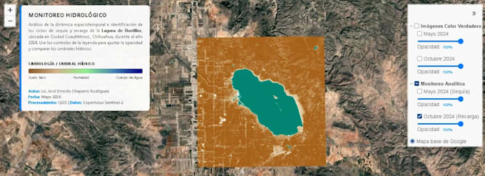
Welcome! If you need professional remote sensing analysis and GIS mapping, you are in the right place. I am a Geoinformatics Specialist focused on transforming satellite imagery into actionable spatial data.
What I offer in this Gig:
Satellite Data Processing: Imagery acquisition and cloud masking (Sentinel-2 and Landsat).
Comprehensive Spectral Indices: Calculation of NDVI, NDWI, MNDWI, SAVI, EVI, NBR, or any specific index your project requires.
Spatial Analysis: Multi-temporal change detection, water resource monitoring, and vegetation health assessment.
High-Quality Deliverables: Professional map layouts, clear legends, technical summaries, and source files (GeoTIFF, Shapefiles).
I work with industry-standard software like QGIS and ArcGIS Pro to ensure scientific accuracy.
Please contact me before placing an order so we can discuss your specific project goals and data availability!
GIS and Remote Sensing Specialist
Languages
