Browse categories
Explore
Fiverr Pro
English
$
USD
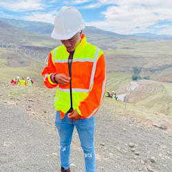


Are you looking for a professional, accurate GIS map for your site, project, or research?
I am a Civil Engineering graduate with a Fundamentals of GIS certification from the University of California, Davis (Coursera) achieved at 94.64%. I use ArcMap to produce georeferenced site location maps, topographic contour maps, drainage analysis maps, and spatial analysis outputs for construction, research, and infrastructure projects.
My GIS work has been applied in real engineering projects, including a structural investigation of a reinforced concrete building where I produced georeferenced site maps and topographic contour analysis that were presented in a formal research report.
What I can produce for you:
- Georeferenced site location maps with coordinates, scale bar, north arrow and legend
- Topographic contour maps showing elevation and terrain profile
- Drainage pattern and surface runoff analysis
- Site boundary delineation and footprint mapping
- High resolution exports in PDF, PNG or JPEG
What I need from you:
- Site coordinates or address
- Project name and intended use
- Any specific features to highlight
- Preferred output format and size
I take accuracy seriously.
Languages
What software do you use?
I use ArcMap (ArcGIS) as my primary GIS platform, supported by Google Earth and WMS for imagery where needed.
Do you need me to provide coordinates?
If you have site coordinates I can use them directly. If not, I can work from an address or description to locate and georeferenced your site.
What file formats do you deliver?
I deliver in PDF, high-resolution PNG, or JPEG. For the Premium package I also include a written spatial analysis report.
Can you work on sites outside Lesotho?
Yes. GIS analysis is location-independent — I can produce maps for any site globally as long as satellite imagery is available for the area.


