Browse categories
Explore
Fiverr Pro
English
$
USD

Laahiru
@flhiru
Drone Mapping, GIS Related Works, Graphic Design
Sri Lanka
About me
I am a GIS Technician and IT professional with experience in GIS mapping, drone photogrammetry, data visualization, and computer support.
My services include:
🗺️ GIS mapping, digitization, georeferencing, ArcGIS & QGIS
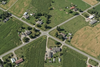
🚁 Orthomosaics, DEM/DSM, contour maps, 3D models & point clouds
📊 Data processing, cleaning, conversion & visualization
💻 Computer hardware, software & IT support
🎨 Graphic design and image editing
I focus on accuracy, quality, and client satisfaction. Let's bring your ideas and data to life!
Skills

Laahiru
Offline •
See my services

Geographic Information Systems (GIS)
I will process drone images into orthomosaic, dem and 3d models

Geographic Information Systems (GIS)
I will create gis maps and convert kml kmz shp CSV gps data
Work experience
GIS Technician
Government Agency • Full-time
Dec 2020 - Present • 5 yrs 10 mos
"As a GIS Technician, my primary responsibilities included digitizing paper maps, maintaining spatial attribute data, conducting field surveys using GPS, and updating spatial datasets in ArcGIS."
4 Reviews
| (4) | ||
| (0) | ||
| (0) | ||
| (0) | ||
| (0) |
Rating Breakdown
- Seller communication level
- Quality of delivery
- Value of delivery
1-4 out of 4 Reviews
Sort By
Most relevant

marchurnivt

Switzerland
Ongoing collaboration
Seller's Response
Helpful?

marchurnivt

Switzerland
Ongoing collaboration
Seller's Response
Helpful?

marchurnivt

Switzerland
Ongoing collaboration
Helpful?

marchurnivt

Switzerland
Ongoing collaboration
Helpful?