Hi?
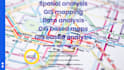
Are you in need of high-quality spatial analysis or custom GIS-based maps? I offer expert-level services using ArcGIS, QGIS, and Google Maps to deliver precise, data-driven solutions for your project.
Services Offered:
️ Custom Map Creation
- Thematic and topographic maps
- Land use, zoning, demographic, and environmental maps
GIS-Based Analysis
- Spatial analysis (buffer, overlay, network)
- Suitability and site selection
- Hydrological and terrain analysis
Location Mapping & Visualization
- Interactive maps using Google Maps
- KML/GeoJSON-based mapping and visualization
- Geocoding and reverse geocoding
Data Management
- Georeferencing, digitizing, and data conversion
- Handling shapefiles, CSVs, KML, and GeoTIFFs
Why Work With Me?
- ️ Professional cartographic design
- ️ Accurate and reliable spatial outputs
- ️ Timely delivery and unlimited revisions
- ️ Tailored solutions for research, business, or academic use
Lets bring your geospatial project to lifesend your project details to get started!