Browse categories
Explore
Fiverr Pro
English
$
USD


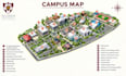
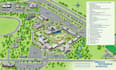
Make your campus easier to understand and navigate with a professional isometric 3D map designed for clear visual communication.
An isometric campus map provides a three-dimensional perspective that helps students, staff, visitors and prospective students identify buildings, facilities, pathways, parking areas, entrances and key landmarks at a glance.
Whether you need a map for a school, university, college or educational centre, I will create a custom vector map using Adobe Illustrator, with clear labels, navigation elements, custom icons and high-quality files for print and digital use.
Maps I Design
Why Hire Me
Not sure which package fits your project? Kindly message me, and Ill help you choose the right option
Please inform the freelancer of any preferences or concerns regarding the use of AI tools in the completion and/or delivery of your order.
GIS Consultant, Expert in Adobe Illustrator and Custom Map Design
Languages
Can you create an isometric map for a university or school?
Yes. I can create isometric maps for universities, colleges, schools, educational centres, and other campus environments.
What can you include on the campus map?
Buildings, facilities, roads, pathways, parking areas, entrances, exits, landmarks, accessibility routes, recreational areas, and other important locations can be included.
Can you create the map from an existing campus plan?
Yes. You can provide an existing site plan, CAD drawing, satellite image, sketch, or other suitable reference.
Can you match our campus branding?
Yes. I can incorporate your logo, colours, typography, and other branding elements into the map.
Can the map be used for print and digital purposes?
Yes. The final map can be prepared for websites, brochures, signage, presentations, orientation materials, and other print or digital applications.


