Browse categories
Explore
Fiverr Pro
English
$
USD
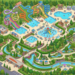
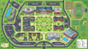
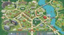
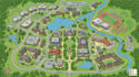
Need a professional university map, campground map, RV park map, event map, navigation map, or school map?
I create custom 2D and illustrated maps that make campuses, outdoor destinations, events, and properties easy to understand and navigate.
I can create:
I can include buildings, classrooms, offices, campsites, RV spaces, event zones, roads, parking areas, trails, entrances, restrooms, recreational facilities, landmarks, directional arrows, labels, legends, and points of interest.
I can also incorporate your logo, brand colors, typography, custom icons, and preferred visual style.
Perfect for universities, schools, campgrounds, RV parks, festivals, events, visitor guides, brochures, websites, signage, presentations, and printed maps.
Send me your existing map, site plan, sketch, survey, reference image, or project details, and I'll create a professional map tailored to your needs.
Please inform the freelancer of any preferences or concerns regarding the use of AI tools in the completion and/or delivery of your order.
map illustration
Languages
Can you create a university or school map?
Yes. I can include buildings, departments, parking, walkways, entrances, facilities, landmarks, and visitor routes.
Can you create a campground or RV park map?
Absolutely. I can show campsites, RV spaces, roads, hookups, amenities, recreation areas, parking, and facilities.
Can you create an event map?
Yes. I can map stages, booths, entrances, parking, food areas, restrooms, activity zones, emergency points, and visitor routes.
Can you add navigation and wayfinding?
Yes. I can include directional arrows, route lines, landmarks, entrances, pathways, and clearly labeled destinations.
Can you work from an existing site plan or sketch?
Yes. I can work from PDFs, sketches, surveys, satellite references, screenshots, or existing maps.
Can you match my branding?
Yes. I can incorporate your logo, colors, typography, icons, and preferred visual style.
Can the map be used for printing and signage?
Yes. I can prepare high-resolution files suitable for brochures, signs, visitor guides, websites, and digital platforms.


