Browse categories
Explore
Fiverr Pro
English
$
USD


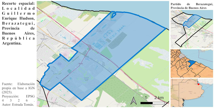
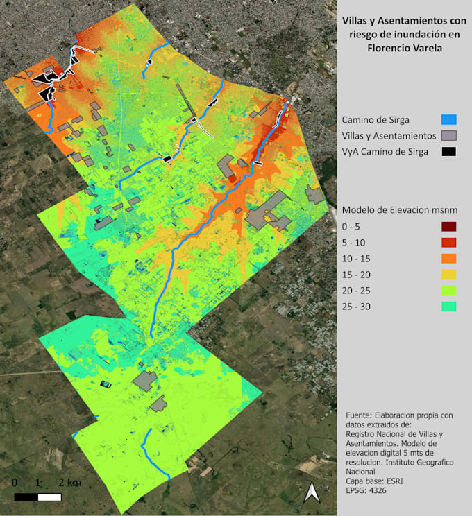
I design custom maps using QGIS, Google Earth Engine, and ArcGIS for projects, research, or personal use.
My services include vectorization, basic statistical analysis, and management of geospatial data such as polygons, lines, and points. I can convert raster data to vector, delimit areas or properties, and create buffer zones.
I also work with digital elevation models (DEM) and add essential cartographic elements such as scale, coordinates, legends, and references.
Additionally, I focus on map design and visual consistency, creating clean and professional maps suitable for presentations.
I deliver clear, accurate, and visually appealing results tailored to your needs. Feel free to contact me before ordering.
Languages