Browse categories
Explore
Fiverr Pro
English
$
USD
I provide professional hydrological modelling using HEC-HMS for rainfallrunoff analysis, watershed assessment, and water resources planning. I help students, researchers, and environmental consultants understand catchment hydrology through GIS-based data preparation and hydrological simulations.
My services include watershed and sub-basin delineation, basin model setup, rainfall data preparation, runoff estimation, hydrograph generation, peak discharge analysis, and interpretation of model results. I also use ArcGIS Pro and QGIS to process terrain data, drainage networks, and catchment boundaries.
Depending on your project needs, I can deliver HEC-HMS model files, maps, simulation outputs, and technical reports. I can also assist with model calibration and validation when suitable observed streamflow data are available.
Whether you are working on a research project, flood assessment, drainage study, or watershed management plan, I aim to provide clear, organised, and reproducible outputs.
Please contact me before ordering to discuss your study area, available datasets, modelling requirements, and expected deliverables.
1. What information do you need to start modelling?
I need your study area, project objectives, available rainfall and streamflow data, and any existing watershed files or modelling requirements.
2. Can you delineate a watershed using GIS?
Yes. I can assist with watershed and sub-basin delineation using suitable DEM data and GIS tools.
3. What outputs will I receive?
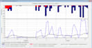
Depending on your package, outputs may include HEC-HMS project files, hydrographs, peak discharge estimates, GIS maps, simulation results, and a technical report.
4. Can you work with my existing HEC-HMS model?
Yes. I can help review model setup, troubleshoot errors, adjust model parameters, and interpret results, depending on the available files and project scope.